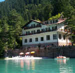
Vacanze al Lago di Molveno, Dolomiti di Brenta
![]()
![]()
![]()
![]()
![]()
![]()
![]()
![]()
![]()
![]()
![]()
![]()
![]()
![]()

|
RIFUGIO SELVATA, BRENTA DOLOMITES, TRENTINO: Excursions starting and finishing at the Selvata Refuge |
| Circular tours from the Selvata Refuge:Tour of the Seghe Valley. To the Selvata and Malga Andalo Refuges and back along the Donini path | |||||
|
Difficulty: short stretch has fixed rope supports |
maximum height : m.1630, Rifugio Selvata |
||||
|
difference in height: |
|||||
Comment: An interesting itinerary that connects the two sides of the Seghe Valley |
|||||
| area | path | height | time between areas | time from start | notes, route variations |
| Rifugio Selvata | 332 | 1630 | 0 | 0 | MAP |
| Rifugio Malga Andalo | s.Donini | 1357 | 1,00 | 1,00 | |
| Località Pontesel | 319 | 920* | 1,00 | 2,00 | take left, northwards |
| Baito Orsi | 319 | 1180* | 0,35 | 2,35 | - |
| Tabelle, fork 319-322 | 322 | 1300* | 0,25 | 3,00 | - |
| Rifugio Croz Altissimo | - | 1430 | 0,25 | 3,25 | - |
| Rifugio Selvata | 332 | 1630 | 0,40 | 4,05 | - |

Val delle Seghe, Lago di Molveno Pradel e Malga Andalo
| Circular tours from the Selvata Refuge : Tour of Monte Daino via the Ceda Valley, Pedrotti Refuge, Massodi Valley and Selvata Refuge | |||||
|
Difficulty: short stretch has fixed rope supports |
Qmaximum height :rifugio Pedrotti, m.2491 |
||||
|
difference in height: 1134 |
|||||
Comment: From the Ceda Valley to the Seghe Valley via the Pedrotti, Selvata and Malga Andalo Refuges. Tiring route but extremely interesting for the views and the areas it passes through |
|||||
| area | path | height | time between areas | time from start | notes, route variations |
| Rifugio Selvata | 319 | 1630 | 0 | 0 | MAP |
| Malga Andalo | 332 | 1357 | 1,10 | 1,10 | - |
| Rovine di Malga Ceda bassa, fork 326 | a destra | 1440 | 0,45 | 1,55 | |
| Cresta di Cima Ceda , fork 320, 326 | 326 | 2414 | 3,00 | 4,55 | - |
| Base sud Cima brenta Bassa, fork 304,320 | 320 | 2470 | 1,15 | 6,10 | - |
| Rifugio Pedrotti | 319 | 2491 | 0,10 | 6,20 | - |
| Rifugio Selvata | - | 1630 | 1,30 | 7,50 | - |
 |

|
| Percorso ad anello attorno al Monte Daino |
Il Gruppo di Brenta dal Pian di Tovre, Rifugio Montanara |
| Circular tours from the Selvata Refuge: From Val Massodi to Val Perse along the Orsi path, nr 303 | |||||
|
Difficulty: short stretch has fixed rope supports |
maximum height :mt 2480 circa |
||||
|
difference in height: m.1050 |
|||||
Comment: |
|||||
| area | path | height | time between areas | time from start | notes, route variations |
| Rifugio Selvata | 319 | 1630 | 0 | 0 | MAP |
| Alta Val Massodi,fork 319-303 | 303 | 2470 | 2,00 | 2,00 | - |
| Val Perse,fork 303-322 | 322 | 2480 | 2,00 | 4,00 | - |
| Rifugio Croz Altissimo, fork 322,340 | 340 | 1430 | 2,05 | 6,05 | - |
| Rifugio Selvata | - | 1630 | 0,40 | 6,45 | - |
Visualizza Parco Adamello Brenta, Settore Brenta in una mappa di dimensioni maggiori