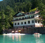
Vacanze al Lago di Molveno, Dolomiti di Brenta
![]()
![]()
![]()
![]()
![]()
![]()
![]()
![]()
![]()
![]()
![]()
![]()
![]()
![]()

|
ALPENROSE REFUGE, BRENTA DOLOMITES, TRENTINO: Connections with other refuges |
| Connections with other refuges: to the Malga Andalo Refuge via the Doré Valley, the Rossati Pass and the Ceda Valley | |||||
|
Difficulty: Difficult, not always well marked, long and tiring |
maximum height : m.2358, Passo dei Rossati |
||||
|
difference in height: 1280 metri |
|||||
Comment: An unusual itinerary, off the beaten track, only for the very fit and expert with a good sense of direction. |
|||||
| area | path | height | time between areas | time from start | notes, route variations |
| Rifugio Alpenrose | - | 1074 | 0 | 0 |  Cartina su gentile concessione Editrice La Giralpina |
| Prada, fork 345 bis | 345 | 1541 | 1,20 | 1,20 | |
| Passo dei Rossati | 345 | 2358 | 2,30 | 3,50 | |
| Spigolo est Dos Dalum | 345 | 1980 | 0,50 | 4,40 | Cutting east across the Ceda Valley you come to path 326 and going downhill you get to Molveno or to the Malga Andalo Refuge by turning left a short distance above the ruins of the Malga Ceda Bassa |
| Rovine ex Malga Ceda Alta, connection with s.326 | 326 a dx | 1888 | 0,25 | 5,05 | |
| Rovine di Malga Ceda bassa | dev.ne a sin | 1440 | 1,00 | 6,05 | - |
| Malga Andalo | - | 1357 | 0,45 | 6,50 | - |

Itinerarrio Rifugio Alpenrose Rifugio Malga Andalo lungo Val Dorè e Val di Ceda
| Connections with other refuges: to the Al Cacciatore Refuge via the Forcella Bregain Col and the Malga Ben, paths no.351, 351b and 325 | |||||
Difficulty: not difficult |
maximum height : m.2358, Passo dei Rossati |
||||
|
difference in height: 1550 metri circa. |
|||||
Comment: An interesting itinerary, more tiring and longer and an alternative to the Ambiez Valley one to get to the Agostini Refuge . |
|||||
| area | path | height | time between areas | time from start | notes, route variations |
| Rifugio Alpenrose | 351 | 1074 | 0 | 0 | MAP |
| ex Malga Dorsino | 351 | 1380 | 1,00 | 1,00 | - |
| Eglo, bivio 345 bis-351 | 351 | 1600* | 0,40 | 1,40 | - |
| Forcella Bregain | 351 | 1830 | 0,45 | 2,25 | - |
| Malga Ben, bivio 351-351 bis | 351 b | 1735 | 1,00 | 3,25 | - |
| Ponte di Paride,bivio 351bis-325 | 325 | 1557 | 0,30 | 3,55 | - |
| Rifugio al Cacciatore | - | 1821 | 0,45 | 4,40 | - |

Val Dorè con Cima Ghez e i Rossati visti da Monte Ranzo
| Connections with other refuges: to the Agostini Refuge via the Forcella Bregain Col and the Malga Ben, paths no. 351 and 325b | |||||
Difficulty: not difficult |
maximum height : m.2410, Rifugio Agostini |
||||
|
difference in height: 1330 metri circa. |
|||||
Comment: An interesting itinerary, more tiring and longer and an alternative to the Ambiez Valley one to get to the Agostini Refuge |
|||||
| area | path | height | time between areas | time from start | notes, route variations |
| Rifugio Alpenrose | - | 1074 | 0 | 0 | MAP |
| ex Malga Dorsino | 351 | 1380 | 1,00 | 1,00 | - |
| Eglo, fork 345 bis-351 | 351 | 1600* | 0,40 | 1,40 | - |
| Forcella Bregain | 351 | 1830 | 0,45 | 2,25 | - |
| Malga Ben | 351 | 1735 | 1,00 | 3,25 | - |
| Busa dei Malgani, fork 325b | 325b | 1925 | 1,15 | 4,40 | - |
| Rifugio Agostini | - | 2410 | 1,10 | 5,50 | - |

Il tracciato del sentiero Palmieri Basso lungo la Pozza Tramontana e le Pendici della Cima Brenta Bassa
| Connections with other refuges: to the Pedrotti Refuge via the Doré Valley, the Rossati pass and the Noghera Valley, path no. 345 | |||||
|
Difficulty: Difficult, not always well marked, long and tiring |
maximum height : m.2491, Rifugio Pedrotti |
||||
|
difference in height: 1790 metri circa. |
|||||
Comment: An unusual itinerary, off the beaten track, only for the very fit and expert with a good sense of direction.o. |
|||||
| area | path | height | time between areas | time from start | notes, route variations |
| Rifugio Alpenrose | - | 1074 | 0 | 0 | MAP |
| Prada, fork 345 bis | 345 | 1541 | 1,20 | 1,20 | |
| Passo dei Rossati | 345 | 2358 | 2,30 | 3,50 | - |
| Spigolo est Dos Dalum | 345 | 1980* | 0,50 | 4,40 | |
| Forcolotta di Noghera | 320 | 2423 | 1,30 | 6,10 | |
| Cresta est di C.Ceda, fork 326 | 320 | 2414 | 0,15 | 6,25 | |
| Rifugio Pedrotti | - | 2491 | 1,20 | 7,45 | - |
Visualizza Parco Adamello Brenta, Settore Brenta in una mappa di dimensioni maggiori