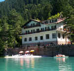
Vacanze al Lago di Molveno, Dolomiti di Brenta
![]()
![]()
![]()
![]()
![]()
![]()
![]()
![]()
![]()
![]()
![]()
![]()
![]()
![]()

|
Tour of the Brenta Dolomites north chain, Trentino. IA
5 day hike starting and finishing in Dimaro in the Sole Valle, Trentino.. The
fourth stage runs along the Palete path, a fascinating route but somewhat
difficult, both for its length and for the presence of some exposed stretches
with fixed rope supports.
|
||||||||||
First day from Dimaro to Rifugio Peller via the Cavai Valley
|
difference in height: m. 1350 c.a maximum height: m.2061 |
||||
| area | height | time between areas | time from start | notes, route variations |
| Carciato-Dimaro | 774 | - | 0 | MAP |
| La Gnoca | 904 | 30 | h 0,30 | - |
| ex Malga Cavai, fork 335-308 | 2061 | 180 | h 3,30 | proseguendo per il 335 si arriva a Passo della Nana |
| Lago delle Salare | 2012 | = | - |  Lago delle Salare |
| Malga Clesera | 1889 | 60 | h 4,30 | - |
| Rifugio Peller | 2022 | 50 | h 5,20 | - |
2nd day:: Rifugio Peller - Lago di Tovel via the Madris Valley
| area | path | height | time between areas | time from start | notes, route variations |
| difference in height: m.475 | maximum height: m.2502 | ||||
| Rifugio Peller | 336 | 2022 | 0 | 0 |  Rif.Peller |
| vic.Malga Tassulla | 336 | 2090 | 1,00 | 1,00 | - |
| Passo della Nana, fork 335, 336 | 336 | 2195 | 0,45 | 1,45 | - |
| Passo di Prà Castron | 310 | 2502 | 1,30 | 3,15 | maximum height |
| Prà Castron di Tuenno, fork 306 | 310 | 2220 | 0,45 | 4,00 |  Malga Tassulla,Biv.Pinamonti |
| Val Madris, fork 380 | 310 | 1800* | 1,15 | 5,15 | - |
| Malga Tuena, fork 310 | 309 | 1740 | 0,15 | 5,30 | - |
| Lago di Tovel | - | 1189 | 1,20 | 6,50 | MAP |

Rifugio Orso Bruno e il Gruppo Cima Rocca Cima Sassara
3nd day:: Lago di Tovel - Rifugio Graffer via the Flavona Valley
|
difference in height: m.1250 maximum height: m.2442 |
|||||
| area | path | height | time between areas | time from start | notes, route variations |
| Lago di Tovel | 314 | 1189 | 0 | 0 | - |
| Ponte sulla Dena, fork 312 | 314 | 1415* | 0,50 | 0,50 | - |
| Ponte Rio Tresenga, fork 334,369 | 314 | 1560 | 0,30 | 1,20 | - |
| Malga Pozzol, fork 371 | 314 | 1632 | 0,15 | 1,35 | - |
| vic.ze Malga Flavona, fork 330 | 314 | 1810* | 0,45 | 2,20 | - |
| Val S. Maria Flavona, fork 314 | 301 | 2206 | 1,15 | 3,35 |  Sasso Rosso |
| Passo del Grosté | 301 | 2442 | 0,40 | 4,15 | |
| Rifugio Graffer | - | 2262 | 0,30 | 4,45 | - |
4th day: Rifugio Graffer - Rifugio Peller along the Sentiero delle Palete, n.306
|
difference in height: m.350 circa maximum height: m.2442 |
|||||
| note: percorso impegnativo indicato solo ad esperti ed allenati | |||||
| area | path | height | time between areas | time from start | notes, route variations |
| Rifugio Graffer | 301 | 2262 | 0 | 0 | MAP of the northern section |
| Passo del Grosté | 306 | 2442 | 0,30 | 0,30 | MAP vof the southern section |
| Val de le Giare, fork 334 | 306 | 2177 | 1,00 | 1,30 | - |
| Liveza Grande, fork 312-380 | 306 | 2184 | 2,00 | 3,30 | - |
| Val Pestacavre, fork 380 | 306 | 2054 | 0,30 | 4,00 |  Catena settentrionale del Brenta |
| Prà Castron di Tuenno, fork 310 | 306 | 2220 | 1,30 | 5,30 | - |
| Passo della Nana | 336 | 2195 | 1,30 | 7,00 | - |
| Vicinanza Malga Tassulla, fork 311 | 336 | 2090 | 0,40 | 7,40 | - |
| Rifugio Peller | - | 2022 | 1,00 | 8,40 | - |
5th day: Rifugio Peller - Dimaro via Cavai Valley
| area | path | height | time between areas | time from start | notes, route variations |
| Rifugio Peller | 313 | 2022 | 0 | 0 | - |
| Malga Clesera | 308 | 1889 | 0,50 | 0,50 | - |
| Lago delle Salare | 308 | 2012 | - | - | - |
| ex Malga Cavai, fork 335-308 | 335 | 2061 | 1,15 | 2,05 |  Val di Mezol |
| La Gnoca | 335 | 904 | 2,30 | 4,35 | - |
| Carciato-Dimaro | 335 | 774 | 0,20 | 4,55 | MAP |
| 774 | 0,20 | 4,55 | KARTE |
Visualizza Parco Adamello Brenta, Settore Brenta in una mappa di dimensioni maggiori