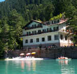
Vacanze al Lago di Molveno, Dolomiti di Brenta
![]()
![]()
![]()
![]()
![]()
![]()
![]()
![]()
![]()
![]()
![]()
![]()
![]()
![]()

|
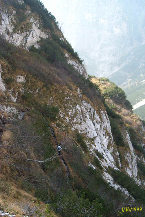
Crossing the Brenta Dolomites, Trentino: from Molveno to Lake Tovel Start
from the top station of the cable car that goes from Molveno up to the Altopiano
di Pradel tableland (open every day from the last week in May to the end of
September and at weekends from the beginning of May and in the first three weeks
of October (check times and dates by phoning 0461-586981 / 586924). |
 |
 |
| Die Brentadolomiten vom Clamer Pass | Auf dem Weg 344 |
 |
 |
|
Percorso Malga Spora Lago di Tovel, elaborazione su gentile concessione Editrice La Giralpina |
Percorso Molveno Malga Spora, elaborazione su gentile concessione Editrice La Giralpina |

| starting point: | Molveno Pradel , mt 1320 |
| finishing point: | Lago di Tovel – Val di Non |
| maximum height: | Passo della Gaiarda, mt 2242 |
| difference in height | 1236 m. |
| time required | 7-8 hours |
| main peaks crossed | Val delle Seghe, Val Perse, Val Santa Maria Flavona |
| refuges etc. along the way | Malga Spora |
| path numbers | 340, 322, 344, 301, 371, 314 |
| recommended route for early return to base | from Malga Spora to Andalo along the path n.301 |
| level of difficulty | tiring, not difficult |
| recommended period | june-october |
| Bus Connections | Collegamenti autobus Trentino You need your own transport from Lake Tóvel to Tuenno. Then a bus takes you from the two centres in the Non Valley to Mezzolombardo where there is a connection several times a day with Molveno. |

Table of times between points and heights:
| area | path nr. | height | time between areas | time from start | notes,
route variations
|
| Altipiano di Pradel | 340 | 1320 | 0 | 0 | SEE MAP |
| Rifugio Croz Altissimo, fork 322 | 322 | 1430 | 0,50 | 0,50 | |
| Vallazza, fork 322, 344 | 344 | 1600 | 0,30 | 1,20 | turn rightwards |
| Passo Clamer, fork 344,344b | 344 | 2164 | 1,30 | 2,50 | |
| Malga Spora | 301 | 1851 | 0,45 | 3,35 | take the left, northwards |
| Passo Gaiarda | 301 | 2242 | 1,15 | 4,50 | - |
| Campo Flavona, fork 371 | 371 | 2196 | 0,10 | 5,00 | - |
| Malga Flavona, fork 330 | 371 | 1820 | 0,55 | 5,55 | take the left |
| Malga Pozzol, fork 314 | 314 | 1632 | 0,30 | 6,25 | take the right, eastwards |
| Ponte Rio Tresenga | 314 | 1560 | 0,10 | 6,35 | - |
| Lago di Tovel | 314 | 1189 | 1,00 | 7,35 | - |
Visualizza Parco Adamello Brenta, Settore Brenta in una mappa