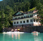
Vacanze al Lago di Molveno, Dolomiti di Brenta
![]()
![]()
![]()
![]()
![]()
![]()
![]()
![]()
![]()
![]()
![]()
![]()
![]()
![]()
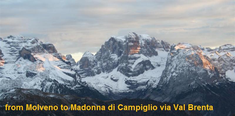
| Crossing
the Brenta Dolomites, Trentino: from Molveno to Madonna di Campiglio via Bocca
di A
classic route across the Brenta Group which winds through the Brenta, Massodi
and Seghe valleys. This itinerary in the opposite direction is advisable if you
wish to start high up from the Grostè Pass and go to the Tuckett Refuge
and then on to the Brentei Refuge. Up until the Croz Altissimo Refuge the
itinerary is the same as the one described in the preceding section. |

Vecchio Rifugio Tosa con alta Val Massodi e, tra le nebbie, Cima
Lasteri e Piz Galin
| suggestions for overnight stays | |
| starting point: |
Molveno Pradel o Molveno Via Dolomiti |
| finishing point: |
Madonna di Campiglio –Rifugio Vallesinella (mt 1513) |
| maximum height: |
Bocca di Brenta mt 2552 |
| difference in height |
mt 1232 ( 1688 se si parte da Molveno paese) |
| time required |
7 – 7,30 hours |
| main peaks crossed |
Val delle Seghe, Valle dei Massodi , Val Brenta |
| refuges etc. along the way |
Rifugio Croz.Altissimo, ( o Rifugio Malga Andalo) Rifugio Selvata, Rifugio Pedrotti, Rifugio Brentei, Rifugio Casinei |
| path numbers |
Path no. 340 (319 if you leave from Molveno itself, 332 if you go towards Malga Andalo – Sevata Refuges) as far as the Selvata Refuge, and then path 319 to the Pedrotti Refuge, 318 to the Casinei Refuge and 317 to the Vallesinella Refuge. |
| Bus Connections | |
| level of difficulty |
tiring but not difficult |
| recommended period |
june - october |
| special remarks |
Much less demanding in the opposite direction |
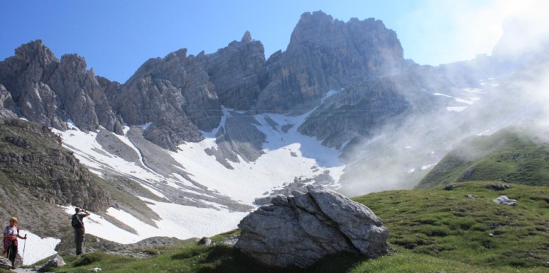
vistas of the upper Massodi
Valley: the Pedrotti Refuge is high up and to the left of the Brenta Alta
Table of times between points and heights:
| area | path nr. | height | time between areas | time from start | notes,
route variations
|
| Molveno,via Dolomiti | 319 | 880 | 0 | 0 | SEE MAP |
| Baita Ciclamino, fork Sent.Donini | 319 | 926 | 0,10 | 0,10 | |
| Busa del Formai, fork 319-322 | 322 | 1300* | 0,50 | 1,00 | path 319 directly to Rifugio Selvata |
| Rifugio Croz.Altissimo, fork 322,340 | 340 | 1430 | 0,30 | 1,30 |  Cartina su gentile concessione Editrice la Giralpina |
| Rifugio Selvata, fork 332 | 319 | 1630 | 0,40 | 2,10 | |
| fork 319-303 | 319 | 2420 | 2,00 | 4,10 | |
| Rifugio Pedrotti | 318 | 2491 | 0,10 | 4,20 | |
| Bocca di Brenta | 318 | 2552 | 0,10 | 4,30 | |
| Rifugio ai Brentei | 318 | 2182 | 0,50 | 5,20 | 
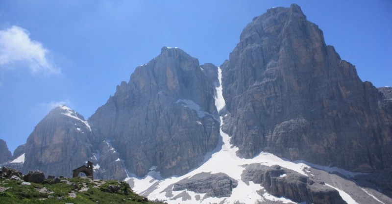
La Bocca di Brenta |
| Valle del Fridolin, fork 328 | 318 | 2048 | 0,50 | 6,10 | 
Croz Altissinmo |
| Rifugio Casinei, sent 318 | 317 | 1825 | 0,25 | 6,35 | take path 317 |
| Rifugio Vallesinella, Madonna di Campiglio | - | 1513 | 0,45 | 7,20 | 
Il vecchio Rif.Tosa |
Chiesetta Brentei e Crozzon di Brenta con il Canalone Neri
|
|