Vacanze al Lago di Molveno, Dolomiti di Brenta

|
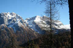
Brenta Dolomites - The access valleys and paths. Gelada di Campiglio valley, path 334 Wonderful climb on foot as an alternative to the ski-lifts to the Graffer Refuge, Grostč Pass and the Costanzi Path. The valley offers magnificent views of the Presanella Group and the towering peaks of the northern chain of the Brenta. It runs from west to east between the Cima Vaglianella and Cima Vagliana peaks to the south, the Corno di Denno and Corno di Flavona peaks to the east and the Sasso Alto and Cima Mondifrŕ peaks to the north. |
| starting point | Malga Mondifrŕ, mt 1632 |
| Connections with public transport | TRENTINO TRASPORTI |
| By motor vehicle | sino a Malga Mondifrŕ |
| Nearest refuges or bivouacs | Rifugio Graffer alont the path 336 Costanzi southwards, Bivacco Bonvecchio a Cima Sassara, sent 336 northwards |
| Main
itineraries
|
a) climb up the Gelada di Campiglio Valley and return through the “Orti della Regina”; b) across to Lake Tóvel along the Giare Valley; c) to Lake Tóvel along the Gelada di Tuenno Valley; ) to the Bonvecchio Bivouac (on the Cima Sassara peak); e) circuit from the east of the Cima Vagliana and Pietra Grande mountains. |
| Difference in height | m.2613, Bocca dei Tre Sassi |
| Maximum height | m.981 ( 1054 per l'itinerario "c") |

La Val Gelada di Campiglio
|
Table of times between points and heights: Malga Mondifrŕ - Bocca dei Tre Sassi |
|||
| Route point |
alt. |
time from start in hours | possible route variations |
| Malga Mondifrŕ | 1632 | - | - |
| detour 334- 336 | - | - | see down "a)" |
| Bocca dei Tre Sassi | 2613 | 2,45 | a) climb up the Gelada di Campiglio Valley and return through the “Orti della Regina”: paths 334 and 336, southwards; b) across to Lake Tóvel along the Giare Valley: paths 334 and 314; c) to Lake Tóvel along the Gelada di Tuenno Valley: paths 334, 336 northwards, 380, 312 and 314;) to the Bonvecchio Bivouac (on the Cima Sassara peak): paths 334 and 336 northwards; e) circuit from the east of the Cima Vagliana and Pietra Grande mountains: paths 334, 306 southwards, 301. |
Visualizza Parco Adamello Brenta, Settore Brenta in una mappa di dimensioni maggiori


