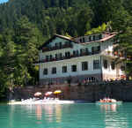
Vacanze al Lago di Molveno, Dolomiti di Brenta
![]()
![]()
![]()
![]()
![]()
![]()
![]()
![]()
![]()
![]()
![]()
![]()
![]()
![]()

|
Crossing the Brenta Dolomites: Sentiero Costanzi A wildly beautiful route that first
meanders over vast grassy meadows to then wend its way along the audacious
crests of the peaks of the northern chain. Dotted with quite demanding stretches
which have fixed rope supports, this route requires fitness, training and the
ability to deal with unpleasant surprises and danger due to changing weather
conditions. However, the vastness and the variety of the views more than make up
for the hard physical effort required. A little used route even in season. From
the Peller Refuge go down towards the Lake Durigal car park and then walk
through the Pian della Nana plain meadows. |
 |
 |
| number of days required | 1- 2 days |
| suggestions for overnight stays | Bivacco Bonvecchio (mt 2779 ) |
| starting point: | Rifugio Peller mt 2022 |
| finishing point: | Rifugio Graffer, m. 2261 |
| maximum height: | metri 2831 ( Cima Rocca) |
| difference in height | about 900 meter |
| time required | 10 –11 hours |
| main peaks crossed | Cima Nana, Sasso Rosso, Cima Benon, Schiena dell’Asino, Cima Benon, Cima Tuena, Cima del Vento, Cima delle Livezze, Cima Rocca, Cima Paradiso, Cima Sassara, Sasso Alto, Corno di Flavona, Cima Vagliana, Pietra Grande |
| refuges etc. along the way | Bivacco Costanzi ( 30 min. from Selletta della Nana), Bivacco Bonvecchio (mt 2779 ) |
| path numbers | 313 till the Lago Durigal, 336 . |
| recommended route for early return to base |
From
the Prà Castron Pass with path no. 329 to Dimaro, 4 hours; again from the
Prà Castron Pass to Lake Tóvel along itinerary 310 to the Malga Tuena
and then along no. 309. From the Bocchetta dei Tre Sassi pass to the Malga
Mondifrà along path 334, 2 hours, then by road to the Campo Carlo Magno
Pass. Again along path no. 334, but going eastwards, you come to Lake Tóvel
in 2 hours. |
| level of difficulty | only for the expert and very fit; tiring and difficult |
| recommended period | june - september |
| special remarks | wonderful route, only for the expert and very fit |
Table of times between points and heights: sentiero Costanzi, n 336
| area | height | time between areas | time from start | notes, route variations |
| Rifugio Peller | 2022 | 0 | 0 | SEE MAP |
| Vicinanza Malga Tassullo, fork 311 | 2090 | 1,00 | 1,00 | to Lago di Tovel viathe Val Formiga Pass |
| Passo della Nana, fork 335-306 | 2195 | 0,45 | 1,45 | s.335 to Dimaro, 306 sentiero delle Palete |
| Selletta della Nana, fork 365 | 2520* | 1,00 | 2,45 | s.365 to Bivacco Costanzi (30 min.) and Dimaro via Val |
| Passo di Prà Castron, fork 310 , 329 | 2502 | 0,30 | 3,15 | s.329 to Dimaro along the Val del Vento, s.310 via M.ga Tuena |
| Bivacco Bonvecchio | 2779 | 3,00 | 6,15 | Cornai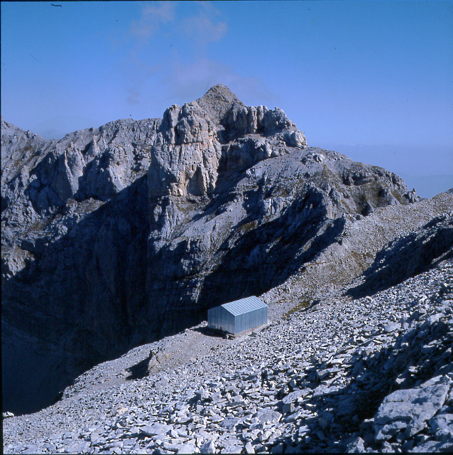 Bivacco Cima Sassara |
| P.sso Val Gelada di Tuenno, fork 380 | 2686 | 1,00 | 7,15 | s. 380 to Val Gelada Tuenno , la Dena and Tovel Lake |
| Bocchetta dei tre Sassi, fork 334 | 2614 | 0,45 | 8,00 | s.334 to Malga Mondifrà or Val de le Giare and Tovel. |
| Sperone degli Orti, fork 390 | 2522 | 1,20 | 9,20 | s.390, via ferrata G.Vidi |
| Rifugio Graffer | 2262 | 0,50 | 10,10 | - |

The northern crest of
the Brenta Dolomites where the Costanzi path runs
Photo Marco Comper
 |
 |
 |
 |
 |
 |
 |
 |
 |
Visualizza Parco Adamello Brenta, Settore Brenta in una mappa di dimensioni maggiori